
Home page
» Administrative Division
» Administrative territorial division
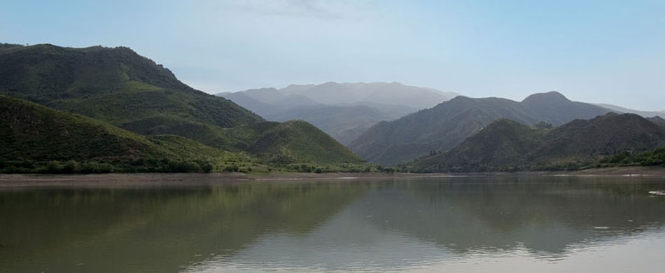
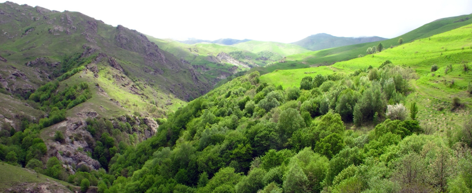
Administrative territorial division 
Yet in 1919 the government of the Azerbaijan Democratic Republic adhered to the principal of traditional historical-geographical administrative division and annexing Shusha, Dkavanshir, Dhabrail and Zangezur regions to Karabakh governorship-general. The government of the Soviet Azerbaijan also demanded Armenia to withdraw its troops from Zangezur and Karabakh in its diplomatic note of April 30, 1920.
However, later 3.105 sq. versts out of total 6.742 sq. versts of Zangezur retained the part of Azerbaijan, while its 3.637 sq.versts were delivered to Armenia. The hardest blow struck to Azerbaijan and the most hostile act was the separation of Nakhichevan from other Azeri lands, and cutting off its contacts with them through delivering a part of Zangezur to Armenia. Moreover, the step was the preparation for the further implementation of Armenia's mean plans concerning Nakhichevan. As a result of purposefully implemented processes of 1920-1923 the lands constituting Karabakh khanate lost their traditional historical-geographical integrity. The country was divided on 15 regions by the list of settlements issued on the basis of the materials of agricultural census enumerations conducted in 1917 and 1921. Karabakh comprised Djabrail (Karyagin), Djavanshir, Qubadly (a part of the former Zangezur region) and Shusha region. Considering various administrative divisions conducted in the Soviet Azerbaijan, the Central Statistical Agency of Azerbaijan made calculations on the area of the country, the national composition and other issues on the basis of the materials of 1921's agricultural census enumeration. They defined that of the historical area of Karabakh (the borders of the khanate) the autonomous province of Daghlig Garabagh with an area 4.160.5 km2, Djabrail region-4.268.5 km2, Aghdam region-4.135.5 km2, Kurdistan-3.432.4 km2 (total 15.996.9 km2) retained the part of Azerbaijan, while part of the historical lands of Azerbaijan were torn from it and granted to Armenia. Further administrative divisions resulted in the establishment of Zengilan (0.7 thousand km2), Qubadly (0.8 thousand km2), Lachyn (1.8 thousand km2) regions on a part of Zangezur preserved within Azerbaijan SSR with definite alterations (first Qubadly, later Kurdistan region).At the same time Aghdam and Djebrail regions were divided into Aghdam (1.1 thousand km2), Barda (1 thousand km2) Aghdjabedi (1.8 thousand km2), Terter (0.4 thousand km2) and Djebrail (1 thousand km2) districts. Thus Karabakh khanate, that played a occupied a worthy place in the history of the Azerbaijani state organization was divided in two parts with one part granted to Armenia while the other part turned to the Autonomous Province of Daghlig Garabagh within Azerbaijan. The resolution of the commission, working our the statue of the Autonomous Province of Daghlig Garabagh provided for the annexation of over 170 districts to the autonomy. The Central Statistical Agency of Azerbaijan noted that in 1924 the number of the districts exceeded 200, while the book of Armenian Q.Kocharyan points out the figure 215. These facts prove that the territory of Daghlig Garabagh expanded and Armenians dominated the number of the population and ethnic composition in the new settlements. Following the establishment of the Autonomous Province of Daghlig Garabagh is's territory was divided in accordance with the principle district-volost-village as follows:
1 Dizag district that comprised 5 volosts (Hadrut, Tugh, Khozaturd, Arakul, Edilli) and 48 villages; 2 Verende district, including 5 volosts (Taghavert, Sus, Chartaz, Norashen) and 46 villages; 3 Shusha district, covering Shusha city and Malybeyli volost (12 villages); 4 Khachyn district, that comprised 4 volosts (Dashbulaq, Askeran, Krasnoselsk, Qala) and 53 villages; 5 Djerabend district. The region covered 4 volosts (Margushevan, Oratag, Dovshanly, Aterk) and 53 villages. In the conduction of the new administrative division a number of alterations were made in the Autonomous Province of Daghlig Garabagh. In August of 1930 its territory again was divided in five districts: 1. Djeraberd, 2. Martuni, 3. Stepanakert, 4. Dizag, 5. Shusha. Obviously, Varanda is called Martuni, the area of Khatuni belonged to Stepanakert. On August 17 of 1939 Djerabert was renamed Mardakert, Dizag acquired the name Hadrut. The policy of widening the towns struck hard blow on Shusha in early 1960th.Shusha district was abolished on January 4, 1963 and its territory transferred to Stepanakert. Shusha district was restored on January 6, 1965. Askeran district was established in place of Stepanakert in 1978. Such administrative division of the Autonomous Province of Daghlig Garabagh existed till the collapse of USSR. 
|
